About
ESA has established the Climate Modelling User Group (CMUG) to place a climate system perspective at the centre of its Climate Change Initiative (CCI) programme, and to provide a dedicated forum through which the Earth observation data community and the climate modelling and reanalysis community can work closely together. CMUG will work with the Essential Climate Variable CCI projects to achieve this goal.
CMUG is a consortium comprising the Met Office Hadley Centre, DLR, ECMWF, IPSL, Météo-France, SMHI, BSC, CMCC, DMI, NCEO (University of Leicester), and NCEO (University of Edinburgh). See CMUG's 'Team' page here.
Why CMUG?
Our climate system is continuously changing, so we need to measure its changes globally and regionally, and to model the system to understand the causes of the changes. Given its global and temporal coverage and spatial resolution, satellite data can be used for both climate monitoring and model initialisation and evaluation.
We need to confront models with observations with the following aims:
- To interpret the observations and explain the causes of observed variability and change;
- To interpret the observations and explain the causes of observed variability and predictions of future change;
- To initialise models for seasonal and decadal timescale predictability.
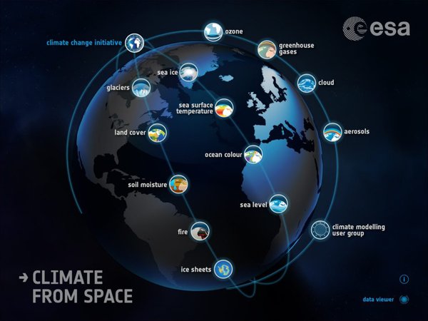
The figure below shows the relations between the CMUG partners and their climate models, the ECVs, climate modellers and ESA.
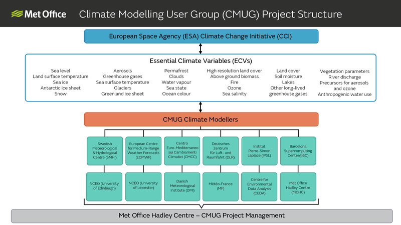
CMUG Objectives
- Support integration within the CCI programme through:
- Requirements and user assessment from the Climate Modelling Community
- Feedback from a 'climate system' perspective
- Foster the exploitation of Global Satellite Data Products within the Climate Modelling Community by:
- Promoting the use of CCI data sets to climate modellers
- Building partnership and links with existing research organisations, networks and scientific bodies of the Climate Modelling Community
- Assess quality and impact of individual/combined Global Satellite Data Products in Climate Model and Data Assimilation context by:
- Assessing suitability of products for climate applications (e.g. climate modelling, decadal prediction, reanalysis, etc)
- Quantifying their incremental value on model performance in an objective manner
Main CMUG Activities
- Refining of scientific requirements derived from GCOS for climate modellers
- Provide technical feedback to CCI projects
- Assess the global satellite climate data records (CDRs) produced from the CCI consortia
- Look specifically at required consistencies across ECVs from a user viewpoint
- Promote and report on the use of the CCI data sets by climate modellers
- Interaction with related climate modelling and reanalysis initiatives
Studies
CMUG Studies for CCI+ Phase 2
CMUG is undertaking several scientific Studies during CCI+ Phase 2 (2023-2026). Each scientific Study is outlined below with a Study description. Study conclusions and results will be provided when ready.
Study WP5.1 - Machine Learning to Advance Climate Model Evaluation and Process Understanding

Study WP5.2 - Impacts and Evaluation of Vegetation Phenology Changes on Observed and Modelled Land-Atmosphere Processes

Study WP5.3 - Impact of Integrating CCI Land Cover data in the ISBA Land Surface Model
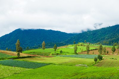
Study WP5.4 - Seasonal Predictability of Ocean Biogeochemistry and Potential Benefits of ESA CCI Data Assimilation

Study WP5.5 - Cloud and Aerosol Analysis

Study WP5.6 - Snow Dynamics Impacts on Temperature / High Latitude Climate

Study WP5.7 - Ice Sheets and Atmospheric Drivers
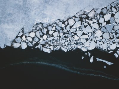
Study WP5.8 - Using Machine Learning to Evaluate and Understand our Capability to Model Tropical Wetland Methane Emissions
Case Studies of work completed during the previous CCI+ Phase 1
CMUG performed case studies making use of CCI ECV data to both test and demonstrate its usefulness for climate science during the previous CCI+ Phase 1. Below provides access to a catalogue of case studies undertaken by the CMUG project during this time.
Aerosols
The Aerosol ECV project provides independently validated, high quality algorithms for processing long-term records of global aerosol properties from European satellite instruments. The Aerosol ECV website can be accessed here. Below is a list of articles about the Aerosol ECV project (newest articles are at the top):
Assimilating ESA CCI Aerosol dataset improves model output
Clouds

The Cloud ECV project is generating long-term and coherent cloud property datasets, generated from the synergistic capabilities of multiple European and non-European Earth observation missions. The Cloud ECV project website can be accessed here. Below is a list of articles about the Cloud CCI ECV project (newest articles are at the top):
Copernicus Climate Data Store Toolbox

The Copernicus Climate Change Service (C3S) mission is to support adaptation and mitigation policies of the European Union by providing consistent and authoritative information about climate change. C3S offer free and open access to climate data and tools based on the best available science. The C3S website can be accessed here. Below is a list of articles about C3S (newest articles are at the top):
Cross-ECV Experiments
Below is a list of articles about cross-ECV experiments (newest articles are at the top):
- Assimilating ESA CCI marine datasets for reanalysis
- Use of ocean CCI data in Met Office model
- Using CCI SST and Clouds for Studying ENSO
ESMValTool

The Earth System Model Evaluation Tool (ESMValTool) is a community diagnostics and performance metrics tool for the evaluation of Earth System Models (ESMs) that allows for routine comparison of single or multiple models, either against predecessor versions or against observations. The ESMValTool website can be accessed here. Below is list of articles about the ESMValTool (newest articles are at the top):
- ESA CCI data for model evaluation: using ESMValTool to validate CMIP6 models
- ESA CCI Land Surface Temperature data are used to assess CMIP6 models using a new ESMValTool diagnostic
- ESMValTool: Assessing, visualising and analysing CCI data
Obs4MIPs
Obs4MIPs (Observations for Model Intercomparisons Project) refers to a limited collection of documented datasets that have been organised according to the Coupled Model Intercomparison Project (CMIP) model output requirements and made available on the Earth System Grid Federation (ESGF). The Obs4MIP website can be accessed here. Below is a list of articles about Obs4MIPs (newest articles are at the top):
Ocean Colour
The Ocean Colour ECV project focuses on the Ocean Colour ECV encompassing water-leaving radiance in the visible domain, derived chlorophyll and inherent optical properties and utilises data archives from Copernicus, ESA, NASA and NOAA. The Ocean Colour ECV project website can be accessed here. Below is a list of articles about the Ocean Colour ECV project (newest articles are at the top):
Ozone

The Ozone project focuses on the generation of multi-decadal time series of harmonised and consistent ozone data suitable to assess long-term changes in total ozone, as well as its vertical distribution. The Ozone ECV project website can be accessed here. Below is a list of articles about the Ozone ECV project (newest articles are at the top):
Sea Ice
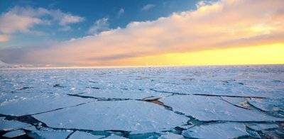
The Sea Ice ECV project aims to advance the retrieval capability for two main variables of the Sea Ice Essential Climate Variable (ECV): sea ice concentration and sea ice thickness. The Sea Ice ECV website can be accessed here. Below is a list of articles about the Sea Ice ECV project (newest articles are at the top):
- Assimilating ESA CCI Sea Ice observations to improve summer predictions in the Arctic and beyond
- A new dimension: The CCI Sea-Ice thickness data set
Sea Level

The Sea Level ECV project's main objective is to produce and validate a Sea Level Essential Climate Variable (ECV) product. This is achieved through four supporting aims. The Sea Level ECV website can be accessed here. Below is a list of articles about the Sea Level ECV project (newest articles are at the top):
Sea Surface Temperature

The Sea Surface Temperature (SST) ECV project aims to make climate data records for SST longer, more stable and more accurate, providing data users with different forms of data and documentation. The SST ECV project website can be accessed here. Below is a list of articles about the SST ECV project (newest articles are at the top):
Snow

The Snow ECV project generates long-time series of daily global snow extent maps from optical satellite data and daily global snow water equivalent products from passive microwave satellite data. The Snow ECV website can be accessed here. Below is a list of articles about the Snow ECV project (newest articles are at the top):
Soil Moisture

The Soil Moisture CCI ECV project generates long-term global soil moisture records that contribute to hundreds of hydrological and climatological studies worldwide, as well as the annual BAMS "State of the Climate" reports. The Soil Moisture ECV project website can be accessed here. Below is a list of articles about the Soil Moisture ECV project (newest articles are at the top):
- ESA CCI Surface Soil Moisture for Evaluation of CMIP6 Models
- Comparison of CCI and GLEAM Soil Moisture products
Deliverables & Documents
Publications & Presentations
CMUG Integration Meetings
- Integration Meeting October 2024
- Integration Meeting November 2023
- Integration Meeting October 2022
- Integration Meeting October 2021
- Integration Meeting November 2019
- Integration Meeting October 2018
- Integration Meeting February 2017
- Integration Meeting March 2016
- Integration Meeting May 2015
- Integration Meeting June 2014
- Integration Meeting June 2013
- Integration Meeting May 2012
- Integration Meeting March 2011
CMUG Newsletters
- CMUG Newsletter for Integration Meeting October 2024
- CMUG Newsletter for CSWG Meeting March 2024
- CMUG Newsletter for Integration Meeting November 2023
- CMUG Newsletter for Integration Meeting October 2022
- CMUG Newsletter for CSWG Meeting April 2022
- CMUG Newsletter for Integration Meeting October 2021
- CMUG Newsletter for CSWG Meeting May 2021
- CMUG Newsletter for CSWG Meeting January 2021
- CMUG Newsletter for CSWG Meeting October 2020
- CMUG Newsletter 6, January 2016
- CMUG Overview Newsletter, August 2015
- CMUG Newsletter 5, June 2015
- CMUG Newsletter 4, September 2014
- CMUG Newsletter 3, January 2013
- CMUG Newsletter 2, October 2011
- CMUG Newsletter 1, December 2010
Scientific Publications
- Acosta-Navarro, J. C., García-Serrano, J., Lapin, V., Ortega, P. (2022). Added value of assimilating springtime Arctic sea ice concentration in summer-fall climate predictions. Environmental Research Letters, 17. 064008. https://doi.org/10.1088/1748-9326/ac6c9b
- Adloff, F., Jordá, G., Somot, S., Sevault, F., Arsouze, T., Meyssignac, B., Li, L., and Planton, S. (2018). Improving sea level simulation in Mediterranean regional climate models. Climate Dynamics, 51, 1167-1178. https://doi.org/10.1007/s00382-017-3842-3
- Albergel, C., Zheng, Y., Bonan, B., Dutra, E., Rodríguez-Fernández, N., Munier, S., Draper, C., de Rosnay, P., Muñoz-Sabater, J., Balsamo, G., Fairbairn, D., Meurey, C. and Calvet, J.-C. (2020). Data assimilation for continuous global assessment of severe conditions over terrestrial surfaces. Hydrology and Earth System Sciences, 24(9), 4291-4316. https://doi.org/10.5194/hess-24-4291-2020
- Bellprat, O., Massonnet, F., Siegert, S., Prodhomme, C., Macias-Gómez, D., Guemas, V. and Doblas-Reyes, F. (2017). Uncertainty propagation in observational references to climate model scales. Remote Sensing of Environment, 203(15), 101-108. http://dx.doi.org/10.1016/j.rse.2017.06.034
- Bilbao, R., Wild, S., Ortega, P., Acosta-Navarro, J., Arsouze, T., Bretonnière, P.-A., Caron, L.-P., Castrillo, M., Cruz-García, R., Cvijanovic, I., Doblas-Reyes, F., Donat, M., Dutra, E., Echevarría, P., Ho, A.-C., Loosveldt-Tomas, S., Moreno-Chamarro, E., Pérez-Zanon, N., Ramos, A., Ruprich-Robert, Y., Sicardi, V., Tourigny, E. and Vegas-Regidor, J. (2021). Assessment of a full-field initialized decadal climate prediction system with the CMIP6 version of EC-Earth. Earth System Dynamics, 12, 173-196. https://doi.org/10.5194/esd-12-173-2021
- Bock, L., Lauer, A., Schlund, M., Barreiro, M., Bellouin, N., Jones, C., Meehl, G. A., Predoi, V., Roberts, M. J. and Eyring, V. (2020). Quantifying progress across different CMIP phases with the ESMValTool. Journal of Geophysical Research: Atmospheres, 125(21). https://doi.org/10.1029/2019JD032321
- Bock, L., and A. Lauer (2024). Cloud properties and their projected changes in CMIP models with low to high climate sensitivity, Atmos. Chem. Phys., 24, 1587-1605, https://doi.org/10.5194/acp-24-1587-2024
- Cheruy, F., Ducharne, A., Hourdin, F., Musat, I., Vignon, É., Gastineau, G., Bastrikov, V., Vuichard, N., Dugresne, J.-L., Ghattas, J., Grandpeix, J.-Y., Idelkadi, A., Mellul, L., Maignan, F., Ménégoz, M., Ottlé, C., Peylin, P., Servonnat, J., Wang, F. and Zhao, Y. (2020). Improved near-surface continental climate in IPSL-CM6A-LR by combined evolutions of atmospheric and land surface physics. Journal of Advances in Modeling Earth Systems, 12(10). https://doi.org/10.1029/2019MS002005
- Dragani, R. (2016). A comparative analysis of UV nadir-backscatter and infrared limb-emission ozone data assimilation. Atmospheric Chemistry and Physics, 16(13), 8539-8557. https://doi.org/10.5194/acp-16-8539-2016
- Eyring, V., Righi, M., Lauer, A., Evaldsson, M., Wenzel, S., Jones, C., Anav, A., Andrews, O., Cionni, I., Davin, E. L., Deser, C., Ehbrecht, C., Friedlingstein, P., Gleckler, P., Gottschaldt, K.-D., Hagemann, S., Juckes, M., Kindermann, S., Krasting, J., Kunert, D., Levine, R., Loew, A., Mäkelä, J., Martin, G., Mason, E., Phillips, A. S., Read, S., Rio, C., Roehrig, R., Senftleben, D., Sterl, A., van Ulft, L. H., Walton, J., Wang, S. and Williams, K. D. (2016). ESMValTool (v1.0) – a community diagnostic and performance metrics tool for routine evaluation of Earth system models in CMIP. Geoscientific Model Development, 9(5), 1747-1802. https://doi.org/10.5194/gmd-9-1747-2016
- Eyring, V., Cox, P., Flato, G., Gleckler, P., Abramowitz, G., Caldwell, P., Collins, W., Gier, B., Hall, A., Hoffman, F., Hurtt, G., Jahn, A., Jones, C., Klein, S., Krasting, J., Kwiatkowski, L., Lorenz, R., Maloney, E., Meehl, G., Pendergrass, A., Pincus, R., Ruane, A., Russell, J., Sanderson, B., Santer, B., Sherwood, S., Simpson, I., Stouffer, R. and Williamson, M. (2019). Taking climate model evaluation to the next level. Nature Climate Change, 9, 102-110. https://doi.org/10.1038/s41558-018-0355-y
- Eyring, V., Bock, L., Lauer, A., Righi, M., Schlund, M., Andela, B., Arnone, E., Bellprat, O., Brötz, B., Caron, L.-P., Carvalhais, N., Cionni, I., Cortesi, N., Crezee, B., Davin, E., Davini, P., Debeire, K., de Mora, L., Deser, C., Docquier, D., Earnshaw, P., Ehbrecht, C., Gier, B., Gonzales-Reviriego, N., Goodman, P., Hagemann, S., Hardiman, S., Hassler, B., Hunter, A., Kadow, C., Kindermann, S., Koirala, S., Koldunov, N., Lejeune, Q., Lembo, V., Lovato, T., Lucarini, V., Massonnet, F., Müller, B., Pandde, A., Pérez-Zanón, N., Phillips, A., Predoi, V., Russell, J., Sellar, A., Serva, F., Stacke, T., Swaminathan, R., Torralba, V., Vegas-Regidor, J., von Hardenberg, J., Weigel, K. and Zimmermann, K. (2020). Earth System Model Evaluation Tool (ESMValTool) v2.0 0 – an extended set of large-scale diagnostics for quasi-operational and comprehensive evaluation of Earth system models in CMIP. Geoscientific Model Development, 13(7), 3383-3438. https://doi.org/10.5194/gmd-13-3383-2020
- Ford, D. A. (2020). Assessing the role and consistency of satellite observation products in global physical-biogeochemical ocean reanalysis. Ocean Science, 16, 875-893. https://doi.org/10.5194/os-16-875-2020
- Ford, D. A., Edwards, K., Lea, D., Barciela, R., Martin, M. and Demaria, J. (2012). Assimilating GlobColour ocean colour data into a pre-operational physical-biogeochemical model. Ocean Science, 8, 751-771. https://doi.org/10.5194/os-8-751-2012
- Ford, D. A. and Barciela, R. (2017). Global marine biogeochemical reanalyses assimilating two different sets of merged ocean colour products. Remote Sensing of Environment, 203, 40-54. https://doi.org/10.1016/j.rse.2017.03.040
- Gier, B., Buchwitz, M., Reuter, M., Cox, P., Friedlingstein, P. and Eyring, V. (2020). Spatially resolved evaluation of Earth system models with satellite column-averaged CO2. Biogeosciences, 17, 6115-6144. https://doi.org/10.5194/bg-17-6115-2020
- Guemas, V., Chevallier, M., Déqué, M., Bellprat, O. and Doblas-Reyes, F. (2016). Impact of sea ice initialization on sea ice and atmosphere prediction skill on seasonal timescales. Geophysical Research Letters, 43(8), 3889-3896. https://doi.org/10.1002/2015GL066626
- Hansen, N., Orr, A., Zou, X., Boberg, F., Bracegirdle, T. J., Gilbert, E., Langen, P. L., Lazzara, M. A., Mottram, R., Phillips, T., Price, R., Simonsen, S. B. and Webster, S. (2024) The importance of cloud properties when assessing surface melting in an offline-coupled firn model over Ross Ice shelf, West Antarctica, The Cryosphere, 18(6): 2897-2916, https://doi.org/10.5194/tc-18-2897-2024
- Hollmann, R., Merchant, C., Saunders, R., Downy, C., Buchwitz, M., Cazenave, A., Chuvieco, E., Defourny, P., de Leeuw, G., Forsberg, R., Holzer-Popp, T., Paul, F., Sandven, S., Sathyendranath, S., van Roozendael, M. and Wagner, W. (2013). The ESA Climate Change Initiative: Satellite Data Records for Essential Climate Variables. Bulletin of the American Meteorological Society, 1541-1552. https://doi.org/10.1175/BAMS-D-11-00254.1
- Kaps, A., A. Lauer, G. Camps-Valls, P. Gentine, L. Gómez-Chova and V. Eyring, "Machine-Learned Cloud Classes From Satellite Data for Process-Oriented Climate Model Evaluation," in IEEE Transactions on Geoscience and Remote Sensing, vol. 61, pp. 1-15, 2023, Art no. 4100515, doi: 10.1109/TGRS.2023.3237008
- Kaps, A., Lauer, A., Kazeroni, R., Stengel, M., and Eyring, V.: Characterizing clouds with the CCClim dataset, a machine learning cloud class climatology, Earth Syst. Sci. Data Discuss. [preprint], https://doi.org/10.5194/essd-2023-424, accepted, 2024.
- Klose, M., Jorba, O., Gonçalves Ageitos, M., Escribano, J., Dawson, M., Obiso, V., Di Tomaso, E., Basart, S., Montané Pinto, G., Macchia, F., Ginoux, P., Guerschman, J., Prigent, C., Huang, Y., Kok, J., Miller, R. and Pérez García-Pando, C. (2021). Mineral dust cycle in the Multiscale Online Nonhydrostatic AtmospheRe CHemistry model (MONARCH) Version 2.0. Geoscientific Model Development, 14, 6403-6444. https://doi.org/10.5194/gmd-14-6403-2021
- Lauer, A., L. Bock, B. Hassler, M. Schröder, and M. Stengel. (2023) Cloud climatologies from global climate models – a comparison of CMIP5 and CMIP6 models with satellite data. Journal of Climate, 36 (2), 281-311. DOI10.1175/JCLI-D-22-0181.1 https://doi.org/10.1175/JCLI-D-22-0181.1
- Lauer, A., Eyring, V., Righi, M., Buchwitz, M., Defourny, P., Evaldsson M., Friedlingstein, P., de Jeu, R., de Leeuw, G., Loew, A., Merchant, C., Müller, B., Popp, T., Reuter, M., Sandven, S., Senftleben, D., Stengel, M., Van Roozendael, M., Wenzel, S. and Willén U. (2017). Benchmarking CMIP5 models with a subset of ESA CCI Phase 2 data using the ESMValTool. Remote Sensing of Environment, 205, 9-39. https://doi.org/10.1016/j.rse.2017.01.007
- Lauer, A., Eyring, V., Bellprat, O., Bock, L., Gier, B., Hunter, A., Lorenz, R., Pérez-Zanón, N., Righi, M., Schlund, M., Senftleben, D., Weigel, K. and Zechlau, S. (2020). Earth System Model Evaluation Tool (ESMValTool) v2.0 – diagnostics for emergent constraints and future projections from Earth system models in CMIP. Geoscientific Model Development, 13, 4205-4228. https://doi.org/10.5194/gmd-13-4205-2020
- Lean, K. and Saunders, R. (2013). Validation of the ATSR Reprocessing for Climate (ARC) Dataset Using Data from Drifting Buoys and a Three-Way Error Analysis. American Meteorological Society, 26(13), 4758-4772. https://doi.org/10.1175/JCLI-D-12-00206.1
- Loew, A. (2013). Terrestrial satellite records for climate studies: how long is long enough? A test case for the Sahel. Theoretical and Applied Climatology, 115, 427-440. https://doi.org/10.1007/s00704-013-0880-6
- Loew, A., Stacke, T., Dorigo, W., de Jeu, R. and Hagemann, S. (2013). Potential and limitations of multidecadal satellite soil moisture observations for selected climate model evaluation studies. Hydrology and Earth System Sciences, 17, 3523-3542. https://doi.org/10.5194/hess-17-3523-2013
- Loew, A., Andersson, A., Trentmann, J. and Schröder, M. (2016). Assessing Surface Solar Radiation Fluxes in the CMIP Ensembles. American Meteorological Society, 29(20), 7231-7246. https://doi.org/10.1175/JCLI-D-14-00503.1
- Massonnet, F., Bellprat, O., Guemas, V. and Doblas-Reyes, F. (2016). Using climate models to estimate the quality of global observational data sets. Science, 354(6311), 452-455. https://doi.org/10.1594/PANGAEA.864680
- Merchant, C., Embury, O., Rayner, N., Berry, D., Corlett, G., Lean, K., Veal, K., Kent, E., Llewellyn-Jones, D., Remedios, J. and Saunders, R. (2012). A 20 year independent record of sea surface temperature for climate from Along-Track Scanning Radiometers. Journal of Geophysical Research, 117(C12). https://doi.org/10.1029/2012JC008400
- Peano, D., Hemming, D., Materia, S., Delire, C., Fan, Y., Joetzjer, E., Lee, H., Nabel, J., Park, T., Peylin, P., Wårlind, D., Wiltshire, A. and Zaehle, S. (2021). Plant phenology evaluation of CRESCENDO land surface models – Part 1: Start and end of the growing season. Biogeosciences, 18, 2405-2428. https://doi.org/10.5194/bg-18-2405-2021
- Popp, T., Hegglin, M., Hollmann, R., Ardhuin, F., Bartsch, A., Bastos, A., Bennett, V., Boutin, J., Brockmann, C., Buchwitz, M., Chuvieco, E., Ciais, P., Dorigo, W., Ghent, D., Jones, R., Lavergne, T., Merchant, C., Meyssignac, B., Paul, F., Quegan, S., Sathyendranath, S., Scanlon, T., Schröder, M., Simis, S. and Willén, U. (2020). Consistency of Satellite Climate Data Records for Earth System Monitoring. American Meteorological Society, 101(11), E1948-E1971. https://doi.org/10.1175/BAMS-D-19-0127.1
- Sevault, F., Somot, S., Alias, A., Dubois, C., Lebeaupin-Brossier, C., Nabat, P., Adloff, F. Déqué, M. and Decharme, B. (2014). A fully coupled Mediterranean regional climate system model: design and evaluation of the ocean component for the 1980-2012 period. Tellus A: Dynamic Meteorology and Oceanography, 68(s2). https://doi.org/10.3402/tellusa.v66.23967
- Waliser, D., Gleckler, P., Ferraro, R., Taylor, K., Ames, S., Biard, J., Bosilovich, M., Brown, O., Chepfer, H., Cinquini, L., Durack, P., Eyring, V., Mathieu, P.-P., Lee, T., Pinnock, S., Potter, G., Rixen, M., Saunders, R., Schulz, J., Thépaut, J.-N. and Tuma, M. (2020). Observations for Model Intercomparison Project (Obs4MIPs): status for CMIP6. Geoscientific Model Development, 13, 2945-2958. https://doi.org/10.5194/gmd-13-2945-2020
- Wernecke, A., Notz, D., Kern, S., and Lavergne, T.: Estimating the uncertainty of sea-ice area and sea-ice extent from satellite retrievals, The Cryosphere, 18, 2473–2486, https://doi.org/10.5194/tc-18-2473-2024, 2024.
- Yue, C., Ciais, P., Cadule, P., Thonicke, K. and van Leeuwen, T. (2015). Modelling the role of fires in the terrestrial carbon balance by incorporating SPITFIRE into the global vegetation model ORCHIDEE – Part 2: Carbon emissions and the role of fires in the global carbon balance. Geoscientific Model Development, 8, 1321-1338. https://doi.org/10.5194/gmd-8-1321-2015
- Yue, C., Ciais, P., Cadule, P., Thonicke, K., Archibald, S., Poulter, B., Hao, W., Hantson, S., Mouillot, F., Friedlingstein, P., Maignan, F. and Viovy, N. (2014). Modelling the role of fires in the terrestrial carbon balance by incorporating SPITFIRE into the global vegetation model ORCHIDEE – Part 1: simulating historical global burned area and fire regimes. Geoscientific Model Development, 7(6), 2747-2767. https://doi.org/10.5194/gmd-7-2747-2014
- Zheng, Y., Albergel, C., Munier, S., Bonan, B. and Calvet, J.-C. (2020). An offline framework for high-dimensional ensemble Kalman filters to reduce the time to solution. Geoscientific Model Development, 13(8), 3607-3625. https://doi.org/10.5194/gmd-13-3607-2020
News and events
Team
The CMUG team consists of individuals from the Met Office, European Centre for Medium-Range Weather Forecasts (ECMWF), Météo-France, Deutsches Zentrum für Luft- und Raumfahrt (DLR), Institut Pierre Simon Laplace (IPSL), Swedish Meteorological and Hydrological Institute (SMHI), Barcelona Supercomputing Center (BSC), Fondazione Centro Euro-Mediterraneo sui Cambiamenti Climatici (Fondazione CMCC), Danish Meteorological Institute (DMI), NCEO (University of Leicester), and NCEO (University of Edinburgh).
Met Office
- Amy Doherty
- Richard Jones
- Hannah Griffith
- Debbie Hemming
- Robert King
- David Ford
European Centre for Medium-Range Weather Forecasts (ECMWF)
- Angela Benedetti
- Kirsti Salonen
Météo-France
- Jean-Christophe Calvet
DLR
- Axel Lauer
- Lisa Bock
CEDA
- Alison Waterfall
Institut Pierre Simon Laplace (IPSL)
- Frédérique Cheruy
- Philippe Peylin
- Catherine Ottlé
Swedish Meteorological Hydrological Institute (SMHI)
- Ulrika Willén
Barcelona Supercomputing Center (BSC)
- Pablo Ortega
- Jeronimo Escribano
CMCC
- Daniele Peano
DMI
- Shuting Yang
- Ruth Mottram
NCEO (University of Leicester)
- Robert Parker
- Cristina Ruiz Villena
NCEO (University of Edinburgh)
- Paul Palmer
UKRI STFC
- Alison Waterfall
Biographies
Dr Amy Doherty is the CMUG project manager. She works in the International Applied Science area of the Met Office in the Climate Information for International Development group. She has a Ph.D. in remote sensing and has spent many years working on improving the use of satellite data in the Met Office operational weather forecasts, with a focus on microwave humidity sounders.
Hannah Griffith works on the CMUG project as Work Package 6 lead, Coordination & Outreach. She holds a Physical Geography Bachelors degree and a Sustainable Development & Climate Change Masters degree, both from the University of Exeter. Hannah started working at the Met Office in 2019 and works with climate services, data analysis, international climate resilience programmes and capacity building projects.
Dr. Angela Benedetti holds a Physics degree from the University of Rome, “La Sapienza”, Rome, Italy (under the supervision of Professor Giorgio Fiocco), and a PhD in Atmospheric Science, Department of Atmospheric Science, Colorado State University, Fort Collins, CO (under the supervision of Professor Graeme L. Stephens). Angela joined ECMWF in October 2002 first as a research scientist working on the exploitation of CloudSat data, and later as the aerosol expert in the EU-funded GEMS, MACC, MACC-II, MACC-III projects, and until October 2015 in the EU-funded Copernicus Atmosphere Monitoring Service (CAMS). Since November 2015, she has been a Senior Research Scientist in the Atmospheric Composition Team, part of the Research Department Earth's Predictability Section. Angela's research interests span from Data assimilation with focus on aerosol for improvements in atmospheric composition and meteorological forecasts/analysis, to Dust forecasts, with focus on air quality applications, and more generally Aerosol impacts on Numerical Weather Prediction. She is Principal Investigator and Work Package leader in several international projects (e.g. ARAS, Aerosol Radiance Assimilation Study; A3S, Aerolus/EarthCARE Aerosol Assimilation Study; ACTRIS2, Aerosols, Clouds and Trace gases Research InfraStructure Network - Phase 2; DACCIWA, Dynamics-aerosol-chemistry-cloud interactions in West Africa).
Dr. Jean-Christophe Calvet received a M. Eng. degree in agronomy from AgroParisTech, Paris, France, in 1990, a M.Sc./Eng. degree in meteorology from the Ecole Nationale de la Météorologie, Toulouse, France, in 1990, a Ph.D. degree from the Université Paul Sabatier, Toulouse, in 1996, and a Habilitation degree in 2002 at the same university. He joined Météo-France, Toulouse, the French meteorological service, in 1990, and Centre National de Recherches Météorologiques (CNRM), Toulouse, in 1994, where he has been the Head of a land-modelling and remote-sensing section since 2003 (10 to 15 staff). His most recent works concern the joint analysis of soil moisture and vegetation biomass, and the representation of the carbon cycle in climate models. His research interests include land-atmosphere exchange modelling and the use of remote sensing over land surfaces for meteorology.
Dr. Daniele Peano is a Junior Scientist at CMCC in the “Climate Simulations and Prediction” (CSP) Division. He has three years of experience in ice sheet modelling (PhD) and seven years of experience in land surface and climate modelling (PostDoc). He has contributed to the development of the surface land and vegetation component of the CMCC global coupled model with a specific focus on the land biogeochemical cycle (CMCC-CM2, CMCC-ESM2), and it is working on the development of the new CMCC coupled model (CMCC-CM3). As part of CMUG, he focuses on the evaluation of the impact of vegetation phenology on observed and simulated land-atmosphere processes.
Dr. Frédérique Cheruy is a research scientist at the CNRS and works in the IPSL Laboratoire de Météorologie Dynamique LMD. At the early stage of her career she was specialized in radiative transfer calculations, retrieval of atmospheric products from satellite observations and analysis of satellites date. She re-oriented in atmospheric modelling and has experience regarding parameterizations (land surface and atmosphere), feedback analysis and process oriented diagnostics for evaluating climate models. In the continuity of her collaboration with the IPSL partner during the first phase of CMUG [Cheruy et al. 2017], she will lead the contribution of IPSL to CMUG.
Prof. Dr. Veronika Eyring received her PhD in Environmental Physics from the University of Bremen (Germany) in 1999. She joined the German Aerospace Center (DLR) in 2000 where she is now working as a Senior Scientist and Head of the Earth system model evaluation group. She is Professor of Climate Modelling at the University of Bremen and maintains a strong collaboration with the National Center for Atmospheric Research (NCAR, USA) as Affiliate Scientist. Her research focuses on Earth system modelling and process-oriented model evaluation with observations to better understand chemistry-climate interactions and climate change, and to improve the models. She has authored many peer-reviewed journal articles and has contributed to the Intergovernmental Panel on Climate Change (IPCC) climate and World Meteorological Organization (WMO) ozone assessments since 2004. Veronika is involved in the World Climate Research Programme (WCRP) through her roles as Chair of the Coupled Model Intercomparison Project (CMIP) Panel and member of the scientific steering committees for the Working Group on Coupled Modelling (WGCM), the WCRP Data Advisory Council's (WDAC) Observations for Model Evaluation Task Team, and the Working Group on Numerical Experimentation (WGNE)/WGCM Climate Model Diagnostics and Metrics Panel.
David Ford holds a BSc (Hons) 1st class in Mathematics and Physics from Cardiff University (2002-2005). David has worked on ocean modelling and data assimilation research at the Met Office since 2008. His main focus is on developing and validating the pre-operational global coupled physical-biogeochemical ocean modelling system. His work covers time scales from near-real-time forecasts to decadal reanalyses, with both operational and climate research applications. David has also worked on shelf seas biogeochemical modelling and validation, and developing error covariances for the data assimilation component of the Met Office's operational physical ocean forecasting system.
Catherine Ottlé is a senior researcher at LSCE, with a strong expertise in land surface modelling and remote sensing for climate applications. She contributed to many national and international projects as PI or Co-PI including projects around CNES or ESA satellite missions (such as SMOS, SWOT or TRISHNA) and co-authored more than hundred publications. Her present reasearch interests include the role of land cover and surface properties on surface energy and water budgets and atmospheric feedback. She has been co-leading the land surface - atmosphere interactions (MOSAIC) research team at LSCE since 2014.
Dr Debbie Hemming leads a group of scientists studying vegetation-climate interactions, her personal research is focussed on phenology – the timing of events in nature, and it's interactions with climate. She is also Senior Visiting Research Fellow at the Birmingham Institute of Forest Research, Birmingham University, studying the seasonal dynamics of carbon and nitrogen in their mature woodland Free-Air CO2 Enrichment research site. She leads the scientific direction of her group, and works on a range of projects involved in vegetation responses and feedbacks to climate.
Prof. Richard Jones holds a PhD in Numerical Analysis (1984-1988) and a BSc in Mathematics (1980-1983) from Imperial College, United Kingdom. He was a post-doctoral research scientist at Oxford University from 1987 to 1990. Richard has been working at the Met Office since 1990. He has been a Science Fellow and Manager of Climate Information for International Development team since 2012. He manages and coordinates research into generating and applying regional climate information and modelling systems with a focus on climate risk management, climate change vulnerability and adaptation and international development. Prior to this, Richard was manager of the Regional Climate Prediction team (2002-2012), managing a group of 5-10 scientists generating and applying regional climate information and modelling systems relevant to climate change impacts and adaptation assessment for UK government and international agencies. The previous decade, he was a Senior Scientific Officer, providing state-of-the-art regional climate modelling systems; providing and analysing regional climate change scenarios and advising on these as required under contracts for various UK government departments and international bodies.
Dr. Robert King received a PhD in mathematics in 2011, from the University of Southampton. Joining the Met Office in 2012, Robert initially worked on thermal modelling in a variety of domains, including a strong land surface element. Robert now works in the Vegetation-Climate Interactions teams, researching satellite based techniques around vegetation moisture stress and sub-canopy temperature processes.
Dr Philippe Peylin is a senior scientist at the Centre National de la Recherche Scientifique (CNRS) working on the Carbon Cycle with a 15-year strong expertise in the development of terrestrial ecosystem models and the application of data assimilation techniques to improve the simulations of carbon, water and energy balances. His main research interests concern the links and feedbacks between climate change and terrestrial ecosystem functioning. He is currently coordinating the development of the ORCHIDEE land surface model. He coordinated several research projects, including the H2020 VERIFY project on the estimation of greenhouse gas budgets for European countries.
Dr. Axel Lauer is a research scientist at the Institute of Atmospheric Physics (German Aerospace Center, DLR) and core developer of the Earth System Model Evaluation Tool (ESMValTool). His main research interests are aerosols, clouds and cloud-climate feedbacks as well as their interactions. He has a long-standing experience in evaluating and analysing climate model results and will contribute to Task 5. Specifically, he will help with coordination, support and documentation of ESMValTool CMUG activities and implementation of the new ECVs long-lived GHGs (CH4) and water vapour into the ESMValTool. This includes programming of new diagnostics and metrics that are suitable for evaluating these ECVs from global climate models with the ESA CCI data and application of the ESMValTool to CMIP model results.
Dr. Pablo Ortega has co-lead the Climate Prediction Group at the BSC since September 2017, where he supervises all research activities involving the ocean, sea ice and biogeochemistry, including those within during CMUG. He is particularly interested in the fate of the ocean circulation and Arctic sea ice and their related climate impacts. Many of his current research is focused on identifying the best initialization strategies for seasonal and decadal prediction.
Dr. Ulrika Willén is a research scientist at the Rossby Centre, SMHI, working on regional and global climate modelling especially the parameterization and evaluation of clouds and radiation. She is currently involved in PRIMAVERA, ARCPATH and GREENICE and has previously been involved in EU projects for evaluation of models using ground-based observational networks, such as the CLIWA-NET and CloudNET projects and a number of satellite projects with the Swedish National Space Board, ArcticCLIM, CLOUDMAP and CM SAF projects to assess the use of satellite products in climate Research.
Dr Rob Parker is a lecturer in Earth Observation at the University of Leicester and leads the Carbon-Climate research group. His research interests centre around improving our understanding of key terrestrial processes relevant to climate change, in particular related to the carbon cycle, methane and wildfires. He has developed key satellite methane data products which are extensively used for better understanding the global methane budget and has expertise in using satellite data for evaluation of land surface and climate models. He is currently leading several Environmental Digital Twin activities, bringing together models and data with machine-learning to develop decision support tools.
Prof. Paul Palmer is a Professor at the University of Edinburgh and the science director of the NERC National Centre for Earth Observation. His research is focused on understanding the physical and chemical processes that drive variations in the atmospheric composition of Earth, embracing data, models, and theory. He is a science team member of NASA and Japanese satellite instruments that measure atmospheric GHGs and is the UK co-lead of the French-UK MicroCarb satellite mission. He sits on the European Commission CO2 Task Force that is delivering information to support Europe’s response to the Paris Agreement.
Related Links
Related Links
Click on the links below for further information.
Obs4MIPs
A wide variety of observationally-based datasets are used for climate model evaluation. Obs4MIPs (Observations for Model Intercomparisons Project) refers to a limited collection of documented datasets that have been organised according to the Coupled Model Intercomparison Project (CMIP) model output requirements and made available on the Earth System Grid Federation (ESGF).
This effort was initiated with support from NASA and the U.S. Department of Energy (DOE) and has now expanded to include contributions from a broader community including ESA. Obs4MIPs underpins model evaluation in CMIP (and beyond) and thus makes a significant contribution to the assessment of and sustained improvement in model quality, e.g. as reported by IPCC. The CCI ECV projects contribute ECV data sets, which are decided to be of most interest to the CMIP community, to Obs4MIPs.
CORDEX
The Coordinated Regional Climate Downscaling Experiment (CORDEX) vision is to advance and coordinate the science and application of regional climate downscaling through global partnerships.
ESMValTool
The Earth System Model Evaluation Tool (ESMValTool) is an open-source community-developed diagnostics and performance metrics tool for the evaluation and analysis of Earth System Models (ESMs). ESMValTool allows for a comparison of single or multiple models against predecessor versions and observations. The aim of the ESMValTool is to take model evaluation to the next level by facilitating analysis of many different ESM components, providing well-documented source code and scientific background of implemented diagnostics.
CMIP
The Coupled Model Intercomparison Project (CMIP) is a project of the World Climate Research Programme (WCRP) providing climate projections to understand past, present and future climate changes. CMIP and its associated data infrastructure have become essential to the Intergovernmental Panel on Climate Change (IPCC) and other international and national climate assessments.
GCOS
The Global Climate Observing System (GCOS) ensures that the observations and information needed to address climate-related issues are obtained and made available to all potential users. GCOS expert panels maintain definitions of Essential Climate Variables (ECVs). ESA's Climate Change Initiative (CCI) is a dedicated Essential Climate Variable (ECV) project.
- GCOS – http://gcos.wmo.int
WCRP
The World Climate Research Programme (WCRP) leads the way in addressing frontier scientific questions related to the coupled climate system. The WCRP coordinates and facilitates international climate research to develop, share, and apply the climate knowledge that contributes to societal well-being.
- WCRP – http://www.wcrp-climate.org
C3S
The Copernicus Climate Change Service (C3S) mission is to support adaptation and mitigation policies of the European Union by providing consistent and authoritative information about climate change. C3S offer free and open access to climate data and tools based on the best available science.
Other
Contacts & FAQ
Contact Info
Contact the CMUG project office by email if you require further information.
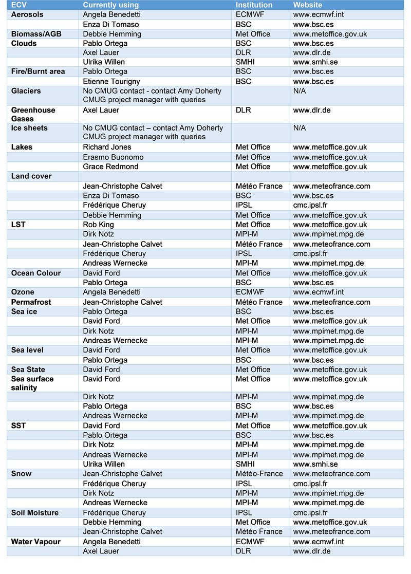
Further contact information for the CMUG partners working with each ECV is presented in the table below.
Partners
NCEO (University of Leicester)
NCEO (University of Edinburgh)
FAQ
Can I feed back my experience using CCI data?
Yes please! We welcome contributors from modellers, scientists, and anybody else.
To send us your ideas or suggestions, to feed back your experience or for other enquiries, please use the contact information at the top of this page.
Do I have to pay for the data?
The data are freely available to scientists and newer versions are becoming available as they are improved over time.
A key benefit is the addition of uncertainty information with the data which is not available elsewhere.
Where can I get the data?
The CCI datasets are available from a dedicated Open Data Portal and related websites, such as Obs4MIPs.
What is CMUG's added value?
CMUG provides scientifically evaluated datasets and uncertainty estimates so that they can be used with confidence by the climate modelling and reanalysis community and other user groups.
The datasets have been assessed by CMUG partners for the validation of essential climate variables (ECVs) in climate models. the evaluation provides quality information to data users, uniquely produced by CMUG, which adds confidence in their application.
How can scientists access and make the best use of the data?
CMUG is providing an independent assessment of the CCI datasets and providing quality flags where issues are identified.
This provides quantitative information on data quality, and improves confidence in their use. The data are promoted to the modelling community to encourage their use and reduce the lead time, sometimes 10-15 years, between being produced and being used for analysis.
The CCI datasets will feed into climate data services, e.g. Copernicus Climate Change Service, set up in Europe as a source for all European climate data.
The CMUG project is providing advice to ESA on how the CCI data will be taken up and used by the climate data services.
What are the benefits of using CCI datasets?
Satellite data aren't always optimally processed and may contain jumps (discontinuities), erroneous data or have other issues. CMUG is re-processing the data to provide datasets useful for climate studies.
CMUG is evaluating a set of essential climate variables (ECVs; defined by GCOS) which were identified by climate scientists as key for climate research.
Examples of their use include ozone climate data record, profiles and total column, which are being used in reanalysis models by ECMWF and other numerical weather prediction modelling centres. This is the most accurate record we have of global ozone.
Another example is the glacier dataset. The glacier team is using CCI data to map changes in the area, thickness and extent of glaciers over time, providing a clear record of changes over the last 15 years compared with the pre-satellite record.
Sea level data provides a very clear indication of sea level rise over the last two decades associated with climate change.
For a full list of ECV projects, visit ESA's page here.
What do CCI datasets provide that is new or different?
CMUG is looking at climate consistency between the essential climate variable datasets, using modelling, reanalyses and quality assessment studies.
Highlights of the CCI datasets are that large-scale climate phenomena (such as El Niño) are consistent between datasets thanks to common data retrievals, but also that the independent processing of each dataset yields an uncertainty characterisation that is uniquely defined for each dataset.
At what stage is CMUG in the programme?
CCI Phase 1
Period: 2010 - 2014
Focus: first dataset from the CCI project
CCI Phase 2
Period: 2014 - 2017
Focus: to include additional datasets and to update the results from phase 1.
One aspect of this project phase was on assessing the consistencies between essential climate variables (ECVs) which is a unique feature of the CCI datasets.
CCI+ Phase 1
Period: 2018 - 2022
Focus: to continue to include additional datasets, to update the results from phase 2, and to conduct further multi-ECV experiments.
Continuation of the assessment of 'climate quality' of ECV consistency between CCI datasets, and the inclusion of uncertainties.
CCI+ Phase 2
Period: 2023 - 2026
Focus: improved tools for facilitating the use of CCI datasets by climate modellers, in-depth assessment of the quality and utility of CCI datasets, new scientific findings on earth system processes, improved communications between climate modelling and observation communities, and a set of deliverables which will be of great use to the CCI ECV projects.
What's next for CMUG?
CMUG CCI+ Phase 2 started in 2023 and will continue until 2026.
Latest news & events

Working for ESA: procurement and proposal submission process
An Introduction to ESA Star - ESA's System for Tendering and Registration
Saber más
Climate Change & Cities: Open Competitive Tenders Launched
Two New City Research Calls On Urban Resilience To Climate Change Using Earth Observation Data
Saber más
ESA at COP29
ESA is participating in COP29 to highlighting satellites' role in tackling climate change
Saber más
Call for new projects: Additional Essential Climate Variables
New R&D procurement as part of ESA's CLIMATE-SPACE programme
Saber más
Call for projects: Interfacing the climate observations and modelling communities
Tender Action Number: 1-12469 (Submission deadline extended to 31 Oct 2024, 13:00 (local Amsterdam time zone)
Saber más
Ocean Salinity Conference 2024
The 7th International Ocean Salinity Science Conference, happening alongside the ESA CCI Salinity
Saber más
Open Competitive Tender for CLIMATE-SPACE Knowledge Exchange
ESA Tender Action Number: 1-12141. ESA Activity Number: 1000039650.
Saber más
Little Pictures winner announced at COP28
Results of Europe-wide climate data visualisation showcased
Saber más
New Tender: CROSS-ECV ACTIVITIES Tender Action Number: 1-12062
New tender issued by the ESA Climate Office (Activity Number: 1000039196)
Saber más


