
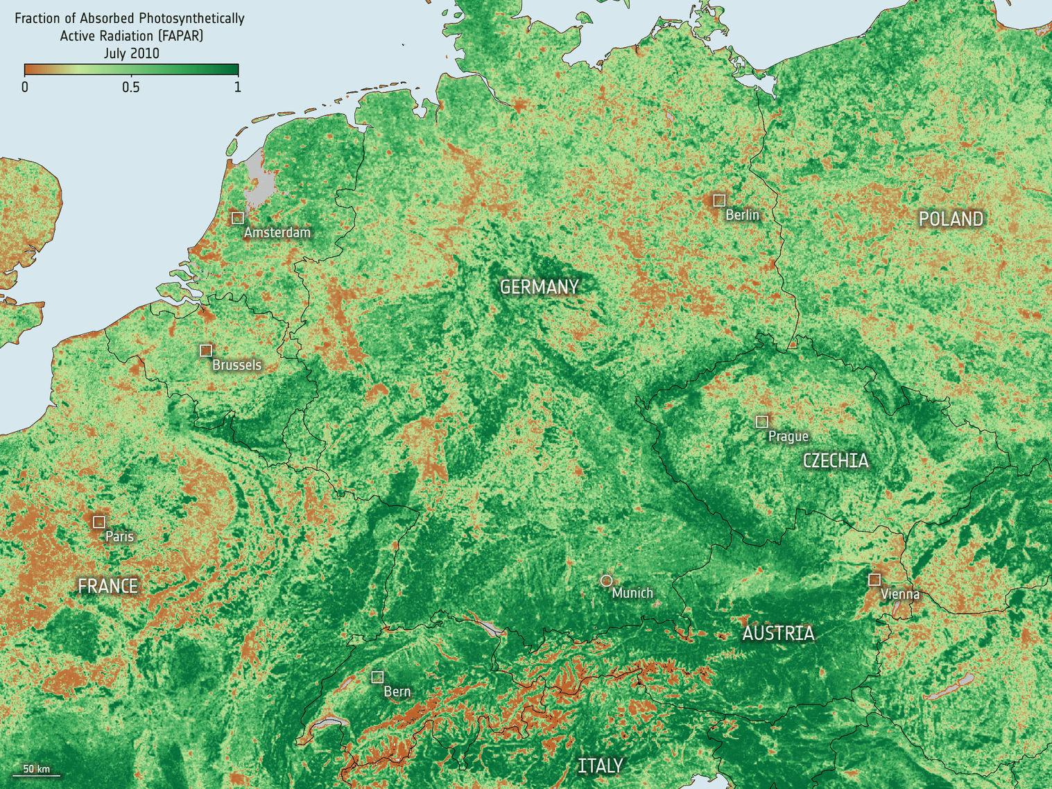
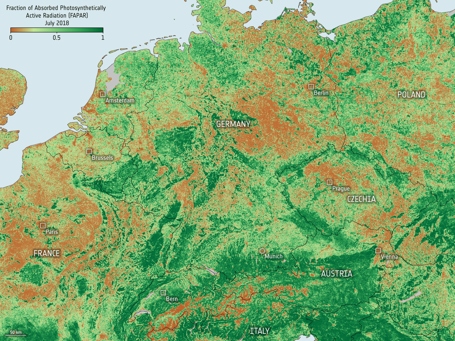
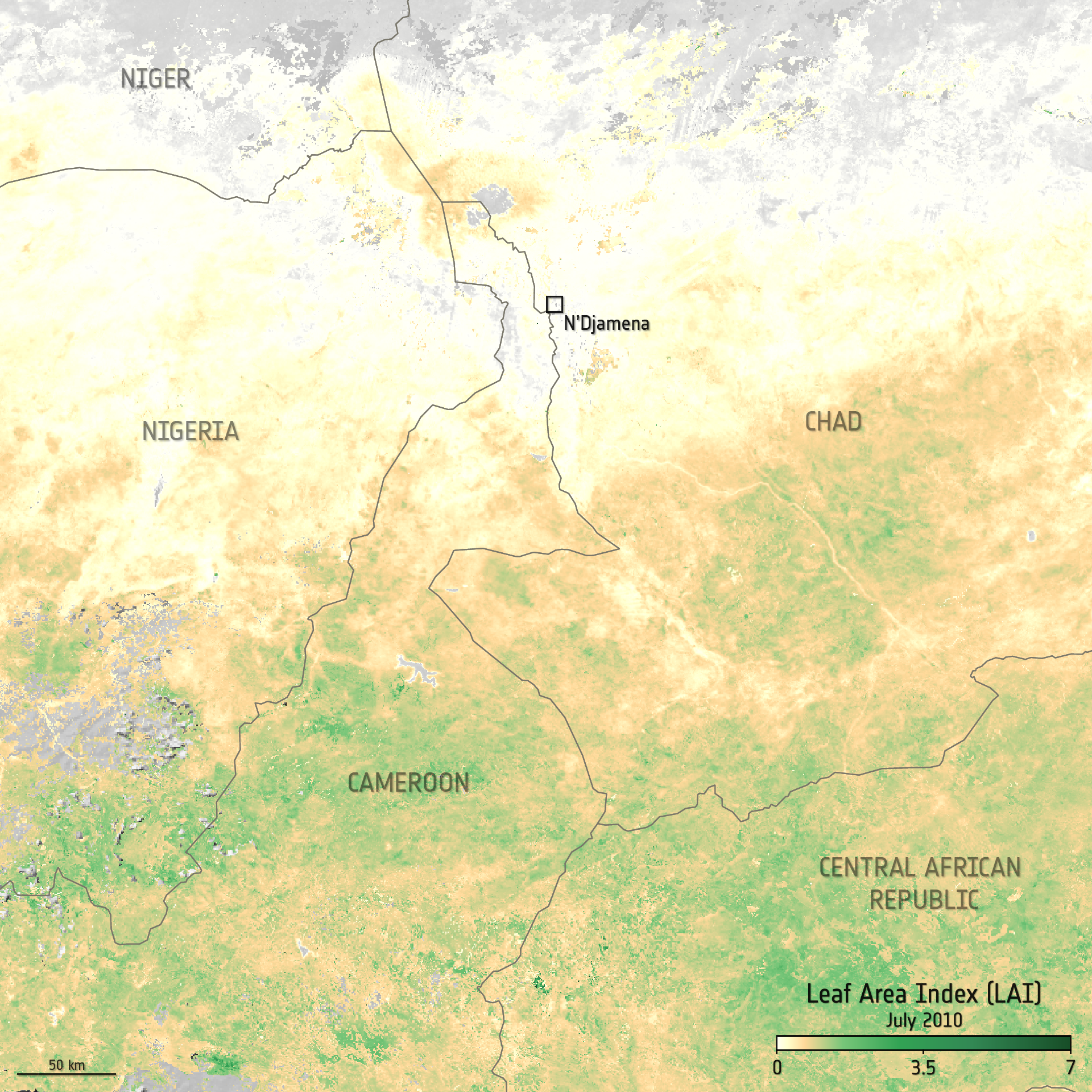
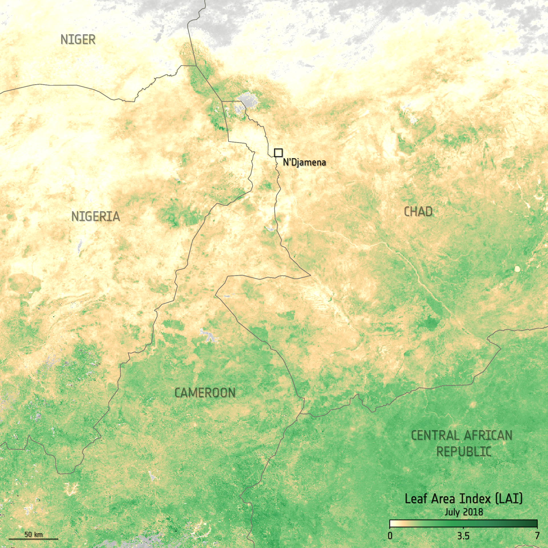
The ESA’s Climate Change Initiative Vegetation Parameters team released a first version of their Leaf Area Index (LAI) and fraction of Absorbed Photosynthetically Active Radiation (fAPAR) data product.
The new product spans 2000-2020 and incorporates observations from multiple satellite sensors – SPOT4/5-VEGETATION1/2 and PROBA-V. Covering a north-south transect from Finland to South Africa and has a 1 km grid spatial resolution. The time step is five days intervals - sufficient for use in global carbon and climate models and an improvement on the 8-10 day period of existing products.
Critically as with all CCI generated products, the dataset provides full uncertainty estimates – a measure of confidence – and traceable validation using global, in-situ measurements.
This first version of the dataset covers a north–south transect from Finland to South Africa. It provides an opportunity for users to familiarise themselves with the data and features in preparation of switching to a global product, which is the next step in the project’s development effort.
Next steps for the project, which runs until the end of 2026, including extending the data globally and incorporating observations from additional sensors such as the Ocean Land Colour Instrument carried on Copernicus Sentinel-3 and the Advanced Very-High Resolution Radiometers carried on the family of US Polar-orbiting Operational Environmental Satellites and Europe’s MetOp satellites.
According to ESA’s Clement Albergel, “The project’s third development cycle will focus on a feasibility study to include solar-induced chlorophyll fluorescence products such as from ESA’s FLEX Earth Explorer mission when it is in orbit, which will provide valuable information on vegetation stress.”