

An updated suite of satellite data products for atmospheric moisture products over land has been released, extending the record and providing improved daily and monthly observations to support water cycle and climate research.
The latest iteration – version 4.2 – extends temporal coverage from 15 to 24 years starting March 2000 to December 2023. The data record charts the total column water vapour over land.
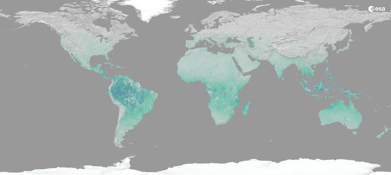
Developed by researchers contributing to the ESA Climate Change Initiative (CCI) the dataset addresses the requirements for the water vapour Essential Climate Variable. It forms one of a basket of 56 aspects of the climate that need to be monitored to enable scientists, and policy makers understand the Earth system.
Water vapour is the most abundant greenhouse gas in the atmosphere. As a climate feedback, it influences global warming and is a key component of the Earth’s hydrological cycle.
Four datasets have been updated and merge observations from the full Moderate Resolution Imaging Spectroradiometer (MODIS) on board the NASA Terra and Aqua missions record, Sentinel-3’s Ocean and Land Colour Instrument A and B (OLCI-A and -B) and the Medium Resolution Imaging Spectrometer (MERIS). Available at daily and monthly intervals and two spatial resolutions, the datasets also include information on the number of Level 2 observations from each sensor contributing to a Level 3 gridded value, alongside revised and extended uncertainty estimates and quality flags.
Four complementary records for atmospheric moisture
The four version 4.2 products provide total column water vapour over land at daily and monthly intervals on 0.05° and 0.5° grids:
- Total Column Water Vapour daily gridded data over land at 0.05 degree resolution, version 4.2
- Total Column Water Vapour daily gridded data over land at 0.5 degree resolution, version 4.2
- Total Column Water Vapour monthly gridded data over land at 0.05 degree resolution, version 4.2
- Total Column Water Vapour monthly gridded data over land at 0.5 degree resolution, version 4.2
Supporting water-cycle and climate research
ESA’s Climate Change Initiative Water Vapour project team, led by the University of Reading, UK, generates global, robust climate data records of total column and vertically resolved water vapour. The project combines satellite observations from multiple instruments to produce records that are as consistent as possible across space and time, with quantified uncertainties for climate research.
Tracking changes in Earth’s climate and water cycle requires observations that are consistent, long-term and freely accessible. ESA's Climate Change Initiative (CCI) is a R&D programme that develops robust satellite-derived climate data records for Essential Climate Variables (ECVs) defined by the Global Climate Observing System. Water vapour is one of these variables, reflecting its central role in the hydrological cycle and Earth’s energy balance. These datasets help scientists and policymakers monitor and understand Earth’s climate system, support climate services and inform action towards the goals of the Paris Agreement.