
About
This project exploits Earth observation data to generate more accurate and improved greenhouse gas (GHG) budgets for key land regions where uncertainties remain significant. Four regions crucial to the global carbon budget have been selected for study: Europe, Siberia, the Amazon, and the Arctic. The project aims to:
- Reduce uncertainty in carbon emissions from sources and removals by sinks
- Facilitate accurate attribution to anthropogenic and global change drivers
- Inform effective climate mitigation strategies
- Support national and global action plans, monitoring, and progress reporting towards the UNFCCC Paris Agreement goals
The project is integrating satellite-derived data records, including those generated via the ESA Climate Change Initiative, into atmospheric inversion models to develop carbon stock and flux estimates of CO2 and CH4.
Once developed, the new Earth observation-based regional carbon stock and change estimates will contribute towards improving the global land carbon budget. This will be achieved through periodic evaluations and reconciliation with national GHG inventories, using a mature framework which in turn support the Global Stocktake mechanism of the UNFCCC Paris Agreement.
Focus Issues
- Reducing uncertainties in regional CO2 and CH4 fluxes due to ecosystems response to climatic variations and land-use changes.
- Improve the alignment between bottom-up (inventory-based) and top-down (atmospheric observation-based) approaches for global carbon and methane budgets.
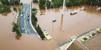
- Use EO-data to overcome some limitations of national inventories in capturing rapid changes (e.g., droughts, extreme fires).
- Deliver frequent EO-data, products and analyses to monitor countries' progress in meeting emission reduction pledges under the Paris Agreement.
The Project Aims To
- Develop a global framework combining satellite data and data-driven modelling approaches to estimate GHG fluxes over sic key global regions and compare, reconcile them with national inventories.
- Reduce the imbalance between sources and sinks in the global carbon budget by targeting key regions where uncertainties are particularly high.
- Reconcile EO-based GHG flux estimates with inventory methodologies, improving monitoring of land-use changes and natural fluxes.
Output of the RECCAP2-CS Project
- High-resolution spatially explicit CO2 and CH4 fluxes for critical regions, including Europe, Siberia, Amazon, and Arctic peatlands.
- Integration of satellite-based ECVs into bottom-up and top-down approaches to improve regional and global carbon budgets.
- A reconciled framework that supports inventory compilers and climate policy stakeholders with enhanced tools for tracking GHG emissions and removals.
- Annual updates of global biomass carbon changes based on passive microwave time series to better understand land carbon stock change anomalies and trends related to extreme events and land-use changes.
The project is structured into three phases:
- Phase 1: EO-based GHG accounting system setup for each region and defining scientific requirements, including stages for requirements specification and system design with iterative feedback.
- Phase 2: developing data processing codes and producing regional GHG budgets from bottom-up, top-down, and inventory approaches, along with uncertainty assessments and initial synthesis for case study regions.
- Phase 3: implementing a pre-operational system for regional GHG budgets, enabling annual updates (year n-1) and providing diagnostics, user feedback, and data visualization to ensure usability and integration with reporting procedures.
Each phase emphasizes collaboration with ESA and the inventory community to refine system requirements, results, and performance.
Team
The team, led by LSCE-UVSQ with 13 subcontractors, brings together experts from previous collaborations, including the CCI RECCAP2 project. With specialized skills in Earth observation, high-resolution mapping, fire data, and carbon fluxes, the team is well-equipped to address the expanded scope and ambitious goals of this project.
Laboratoire des Sciences du Climat et de l’Environnement (LSCE-UVSQ): LSCE is an internationally recognized research laboratory specializing in greenhouse gas (GHG) studies and the development of climate models. It contributes to the project with its expertise in atmospheric monitoring and the development of CO2 flux models over land and oceans.
University of Exeter (UNEXE): a leading research institution in the UK, known for its expertise in climate science and biogeochemical cycles. Its world-class research team collaborates closely with the Met Office, providing cutting-edge expertise on the global carbon cycle.
Universität Leipzig (UL): a leader in environmental sciences and remote sensing technologies. It contributes to the project with its expertise in data-driven methods and modeling to understand ecosystem functioning in a changing world.
INRAE Nouvelle-Aquitaine-Bordeaux: a French research center focused on environmental sciences and sustainable agriculture. Its team is known for its expertise in remote sensing, particularly in modeling soil and vegetation, and studying the water and carbon cycles.
Technical University of Munich (TUM): a world-renowned German university, recognized for its excellence in Earth observation and ecosystem analysis. It brings its expertise in forest disturbance mapping and the use of remote sensing technologies for ecosystem management.
University of Copenhagen (UCPH): one of Europe’s leading institutions, with strong expertise in remote sensing and environmental sciences. Its remote sensing lab focuses on terrestrial ecosystem ecology, especially global land degradation and desertification.
Stockholm University (SU): a key player in environmental sciences and climate change, with research bolstered by the Bolin Centre for Climate Research. It contributes to the project with expertise in physical geography and climate science to better understand the impacts of climate change.
Brockmann Consult GmbH (BC): a company specializing in Earth observation data analysis, focusing on environmental applications. It contributes its expertise in developing software and systems for processing satellite data, particularly for land and water management applications.
Estellus: a small and medium-sized enterprise based in Paris, specializing in satellite data processing and environmental database production. It brings its expertise in integrating satellite observations and developing algorithms for the analysis of remote sensing data.
Citepa: a non-profit organization based in Paris, focused on greenhouse gas emissions inventories and projections. It provides expertise in monitoring, reporting, and verification of carbon fluxes, especially in land-use, land-use change, and forestry.
University of Alcalá (UAH): one of Spain’s most prestigious universities, known for its high-quality research. Its Remote Sensing Research Group leads several climate-related projects, focusing on global burn area datasets and fire risk assessment.
Université Libre de Bruxelles (ULB): one of Belgium’s largest and most prestigious research universities, with a strong focus on Earth system science. Its BGEOSYS unit is a world leader in quantifying greenhouse gas emissions along the aquatic land-ocean continuum.
Fondazione Centro Euro-Mediterraneo sui Cambiamenti Climatici (CMCC): a non-profit research institution focused on climate modeling and its impacts on society and the environment. It conducts comprehensive analyses to inform climate adaptation and mitigation policies.
Kayrros: a French startup that specializes in remote sensing technologies to provide data analysis for the energy, finance, and environmental monitoring sectors. It offers advanced tools for asset observation and environmental analysis, leveraging satellite data to monitor climate-related issues.


Contacts
Science leader - Philippe Ciais
Project Manager - Fatim Hankard
ESA Technical Officer - Clément Albergel